

CASE STUDY IN PERMIAN
Parallel emissions inventories were prepared for dispersion and chemical transport modeling in the Permian Basin. In both inventories, routine emissions of light alkanes from oil and gas sources were estimated with hourly resolution. Emissions were spatially aggregated based on their distance from a centralized air quality monitor and model input requirements. Several tools and datasets including, among others, the Methane Emissions Estimation Tool (MEET), the U.S. EPA Non-Point Oil and Gas Tool, the U.S. EPA Greenhouse Gas Reporting Program (GHGRP), and the U.S. EPA Inventory of Greenhouse Gas Emissions and Sinks (GHGI), were used to develop the emissions estimates. Predictions from a puff dispersion model (CALPUFF) and a chemical transport model (CAMx) with source-tagging capabilities were combined to predict ambient hydrocarbon concentrations at a centrally-located air quality monitor operated by the Texas Commission on Environmental Quality (TCEQ) in Midland TX. Time-matched measurements from the ambient air quality monitor were used to evaluate the model predictions and the relative contribution of near ( ≤ 50km away) and distant (> 50 km) sources. The impact of reactive losses were also evaluated. The framework was further applied to evaluate potential sources of seasonal emissions patterns.
Review Detailed Permian Basin Case Study Framework Flowcharts:
Emissions flowchart (Permian)
Atmospheric Modeling flowchart (Permian)
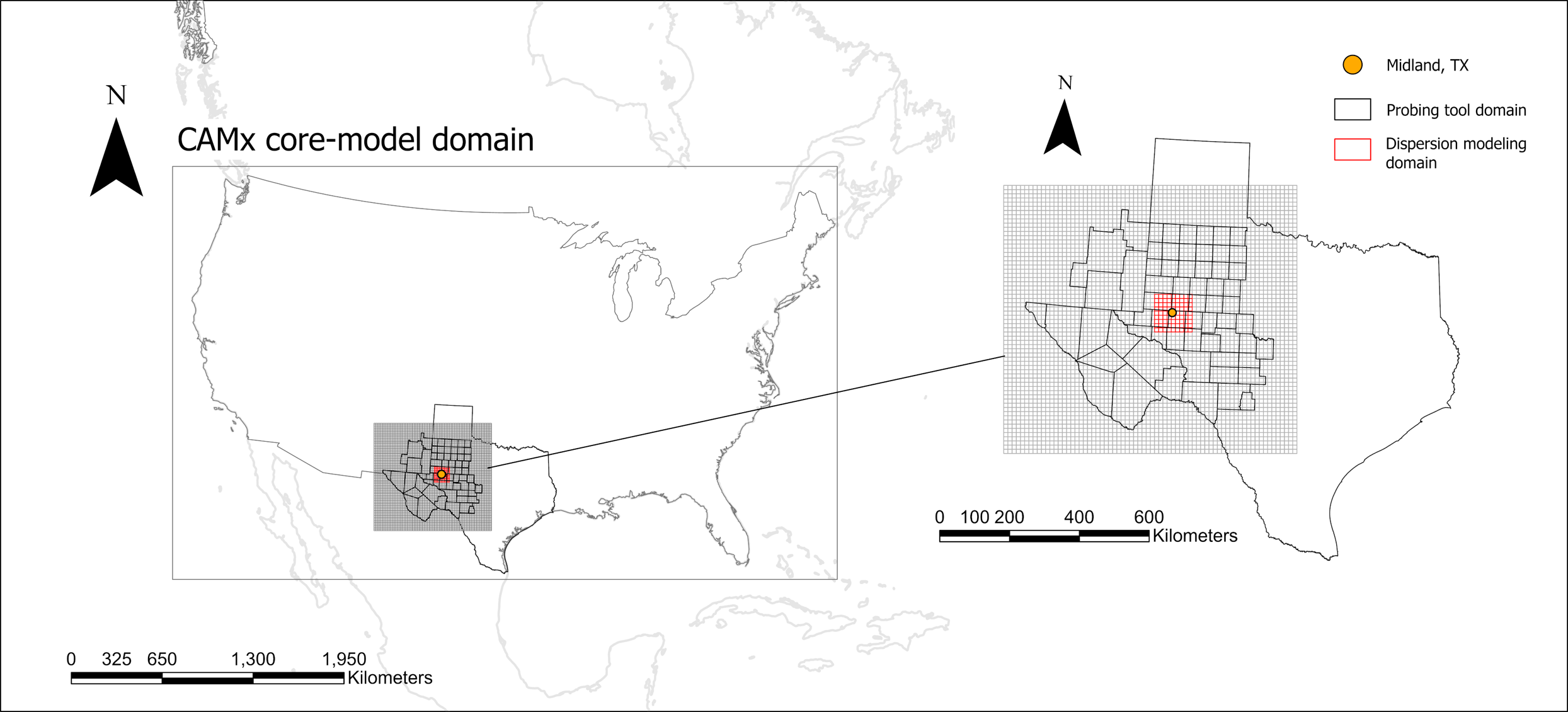
Left panel: Modeling domains used in Permian hybrid modeling analysis.
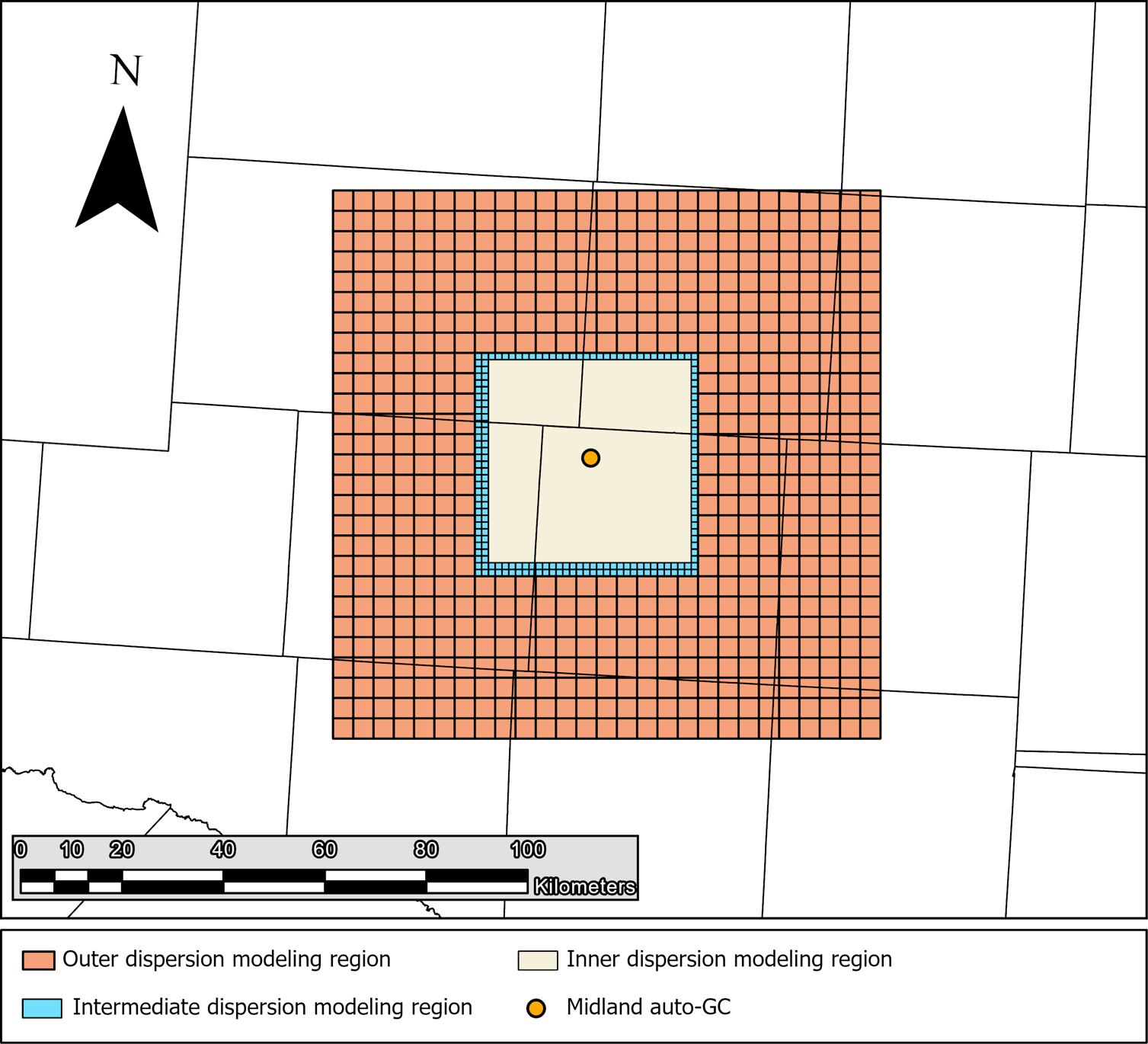
Right panel: Dispersion modeling domain disaggregated into subdomains. Emissions are aggregated to grid cell centroids in the intermediate and outer domains
Figures reproduced from Graves, et. al (2026) under Creative Commons license CC BY-NC-ND 4.0.
Resources
Hybrid modeling pre-print: Graves, et al. (2026)
Emissions seasonality analysis pre-print: Chen, et al. (2026)
Sources for model inputs
Production and completion data: Enverus
Estimating methane emissions from gathering sites: Zimmerle, et al. Methane Emissions from Gathering Compressor Stations in the U.S (2020)
Estimating methane emissions from natural gas processing plants: Mitchell, et al. Measurements of methane emissions from natural gas gathering facilities and processing plants: measurement results (2015)
Land-use data: National Land-Use Consortium Database
Elevation data: National Elevation Dataset (3D Elevation Program Products)
Surface meteorological data (hourly): Integrated surface database
Numerical weather prediction products (meteorological data): High-resolution rapid refresh
Core-model CAMx simulation configuration: 2022 OSAP modeling platform
Tools
Methane Emission Estimation Tool (MEET)
EPA Nonpoint Oil and Gas Tool
Model documentation
Comprehensive Air Quality Model with Extensions (CAMx)
CALPUFF